Saturday 21 March 2015

Another Early Close-up Map of Singapore: Manuel Godinho de Erédia, 1615

Name: Folio 26, Historia de Servicos com Martiro de Luis Monteiro Coutinho 
Year: 1615
Map maker: Manuel Godinho de Erédia
Manuscript map location: Biblioteca Nacional Lisbon, Cod. 414
Figure 1. A 1615 map that portrays a naval battle on the 1st of Jan. 1577, between the Portuguese and Acehnese just south of present day Pulau Tekong.


Figure 2. Google map of the similar area for reference.
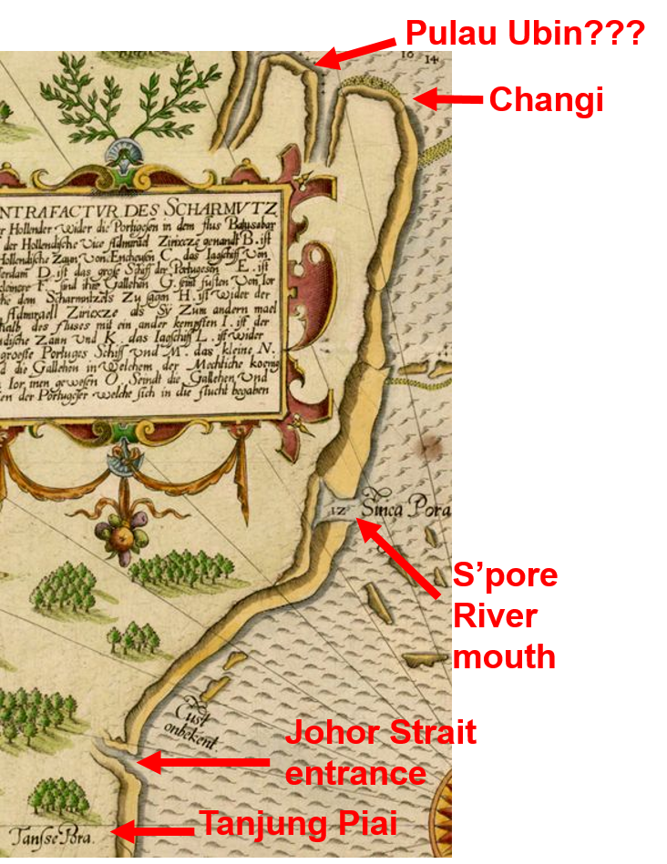
Here is another early map with a close up view of Singapore. This manuscript map comes a few years after the de Bry's map that was mentioned in a earlier blog entry.

What the map (Fig. 1) shows corresponds roughly to the area depicted in the Google map (Fig. 2). The map depicts a naval battle that happened on January 1st, 1577 [1]. In this battle, a Portuguese fleet under Captain-General Mathias de Albuquerque (nephew of Afonso de Albuquerque, the conqueror of Malacca) clashed with a fleet from Aceh at the mouth of the Johor River, just south of Pulau Tekong between Changi and Pengarang. 

This map is from a 1615 manuscript [2] about the life and martyrdom of a Portuguese soldier by the name of Luis Monteiro Coutinho. The manuscript author Manuel Godinho de Erédia is more famous as the author of the Declaracam de Malaca e da India Meridional com Cathay which contains the earliest map that shows Singapore as an island

The busy naval engagement is illustrated in a lively manner with the Portuguese vessels' cannons ablaze and the Acehnese galleys oars in action.   

On the map (Fig, 1) are written several words. They are listed below with the modern references: 
A. Barubuquet : Berbukit (In malay, it means rolling hills). In later maps, the Europeans typically mistook it as the name of the hill that is present day Bukit Pelali. They could also have mistook it for Bukit Pengarang) 
B. Chani : Changi (Present day Pulau Tekong)
C. Rio de Jor : Johor River
D. Tanjon Rusa : Tanjong Rusa (Present day Changi Point)
E. Luís Monteiro Coutinho
F. Mathias de Albuquerque


There are some other interesting points to note which seem to demonstrate the accuracy of this map: The location marked 1. on the map looks like the mouth of Sungei Sebina. The sand bank at 2.  is a common feature in a lot of later maps of Singapore. Nowadays this sandbank does not appear on maps as it has been subsumed under the land reclamation that is Changi Airport today. Could this small island marked 3. be representing Pulau Ubin?

References
[1] P. J. de Sousa Pinto, The Portuguese and the Straits of Melaka, 1575-1619  (NUS Press, Singapore, 2012) pp 276-278.
[2] A pdf file of Historia de Servicos com Martiro de Luis Monteiro Coutinho can be download from this link.

Sunday 8 March 2015

The Earliest Close-up Map of Singapore: de Bry, 1606

Name: Contrafactur des Scharmutz els der Holander... (from Achter Theil der Orientalischen Indien, Frankfurt am Main) 
Year: 1606
Publisher: Johan Theodor de Bry, Johan Israel de Bry & Johan Dieterich de Bry

Figure 1. (L) De Bry's 1607 map featuring a sea battle off the Changi coast. Source image link.  (R) Google map of the similar area for reference. 
The subject of this map is a naval battle that happened on the 10th-11th of October 1603, off the coast of Changi point, Singapore. It would probably be more instructive to understand the location as the mouth of the Johor River. 

This is the earliest known map that provides a close-up view of Singapore. The Google map on the right (Fig. 1 (R)) gives you an idea of the orientation and geographical location of what the de Bry map is depicting. 

Fig. 2. Close-up view of the de Bry map in Fig. 1(L).

In this map, Singapore is not shown to be an island. However the general outline of the south coast of Singapore is reasonably accurate, from Tuas, in the west to Changi in the east. Fig. 2 shows an enlarged view of part of the map in Fig. 1(L) with some the geographical locations identified.

Below are some of the location names marked on the map in Fig. 1(L), and their present day names. 

Oudt Ior : Old Johor. Johor Lama

Rio Batasubar : Present name: Johor River. Batasubar refers to Batu Sawar, the capital of the Johor Sultanate during that time. 

Sinca Pora: Singapura. Likely the mouth of Singapore River

Tansse Pora: Tanjung Buru. Present name: Tanjung Piai, Johor, the southernmost point of the Eurasia landmass

The purpose of the map is not to portray Singapore or Johor river mouth's geography, but to detail a naval encounter between the two dominant naval powers of the day. But why were they battling off the coast of a small island thousands of miles away from their home ground?

The Portuguese and the Dutch were then fighting for supremacy for Melaka Straits and the waters off Singapore. Since their first venture to these waters at the end of the 16th century, the Dutch has been slowly eating away the Portuguese dominance of these waters. The Portuguese had been the dominant power there since conquering Melaka in 1511. The Dutch and Portuguese formed shifting alliances with the local powers of Johor (direct successor to the Melaka sultanate) and Aceh, and engaged in a series of skirmishes through the early 17th century. One major incident was the Dutch seizure of a richly laden Portuguese carrack Santa Catarina off the waters of Singapore in Febuaury 1603 with the help of the Johor sultanate.   

In response, a Portuguese armada under Estêvão Teixeira de Macedo blockaded the mouth of the Johor River (where Changi and Pulayu Tekong are located) to punish the Johor sultanate then based in Batu Sawar, as well as to protect their carracks like Santa Catarina plying the Macau-Melaka trade route, lest they fall prey to the Dutch and Johoreans. A passing fleet of Dutch ships under Vice-Admiral Jacob Pietersz van Enkhuysen, responding to a request by the Johoreans to help lift the blockade, decided to engage the Portuguese fleet. The naval battle lasted from the 10th-11th of October 1603 and resulted in a Dutch victory.

For a much more detailed analysis of the origin and ramification, and blow by blow account of this naval encounter, do read the excellent book by NUS historian Peter Borschberg, entitled The Singapore and Melaka Straits [1]. 

Les Petit Voyages is a series of books that described the various early voyages to the East Indies. The work was initiated by a German publisher based in Frankfurt am Main, Theodor de Bry (1528-1498), and was continued after his death by his descendants. 

The map described in this entry is from the appendix of the eighth book of the Les Petit Voyages series. The book was published by Theodor de Bry's sons Johan Theodor and Johan Israel. There is a German edition (1606): Achter Theil der Orientalischen Indien, and a Latin edition (1607) [2]: Indiae Orientalis Pars Octava, published in 1607. 

From the coastline details and the presence of depth readings on the map, I am guessing that this map was probably derived from an actual navigation chart.

References
[1] P. Borschberg, The Singapore and Melaka Straits: Violence, Security and Diplomacy in the 17th Century  (NUS Press, Singapore, 2013) pp 79-88.
[2] A pdf file of Achter Theil der Orientalischen Indien can be download from this link.